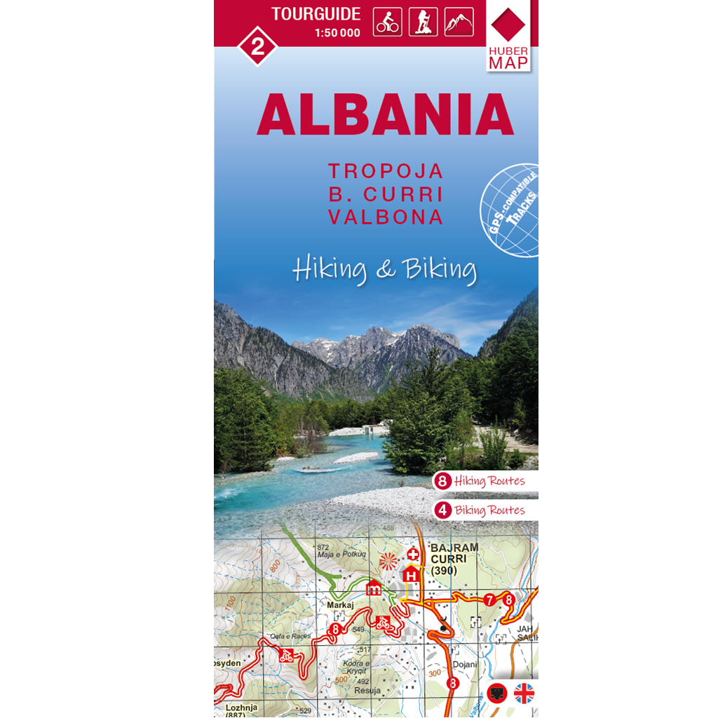
Albania “Hiking & Biking” Tour Guide 1:50,000
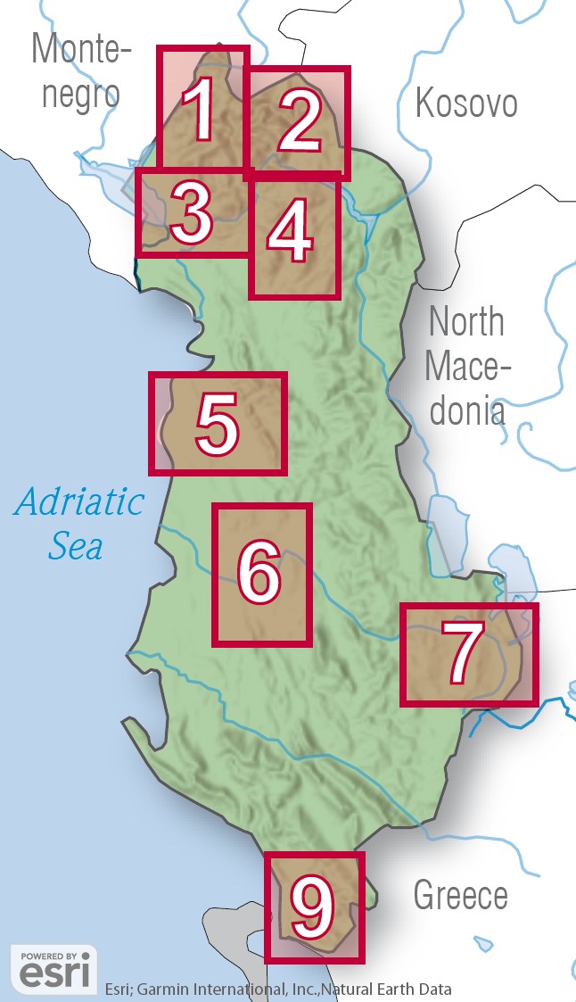
This 4-part series of cycling and hiking maps at a scale of 1:50,000 covers Albania’s most attractive regions. The maps have been supplemented by local tourism associations and institutions with valuable information of tourist interest, such as lodging options, places of interest, and scenic viewpoints. The maps feature numbered, color-coded GPS-compatible cycling and hiking routes, with detailed descriptions found on the reverse side. Additional photos from each region provide a visual impression.
The second map shows the regions of Tropoja, Bajram Curri, and the Valbona Valley in northern Albania. Four cycling tours and eight hiking routes are described in Albanian and English. In addition to the cycling and hiking routes, the detailed topographic map also shows via ferrata, accommodations, places of interest such as churches, monasteries, museums, and theaters, as well as archaeological sites, caves, and viewpoints.
The Albania Hiking & Biking 1:50,000 map series was produced in cooperation with the National Society for Mountainous Studies (SHKSM) and the Albanian Alps Association and funded by the Austrian Development Cooperation.