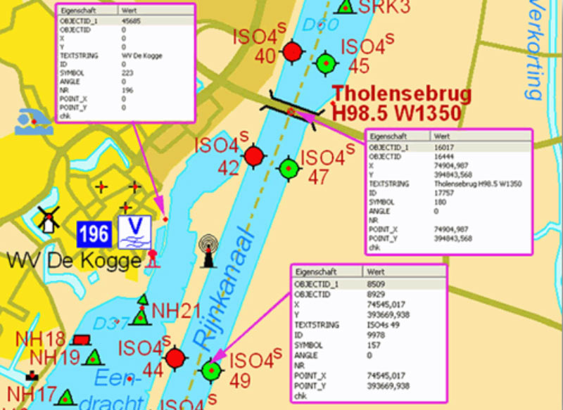
Geo-Data are digital information in the form of geometry and factual data that is assigned a specific spatial location on the earth’s surface. This information is represented by a geometry that generally reflects the position, size and shape of an object on the earth. Geo-Data are used, for example in the fields of logistics, environmental planning, healthcare and navigation for analysis purposes, planning bases and comparisons and is represented in a GIS.

- Geometric data (location description by coordinates)
- Topology (additional spatial relationships)
- Factual data (special object information)
- Graphical representation
- Factual data (special object information)
- Orthophotos, LIDAR images, Digital Elevation Models (DEM)
- Metadata (superordinate information of a geodata set such as projection or resolution)
Data acquisition and analysis
Huber Kartographie GmbH stands for customized cartographic products. In order to be able to offer you customized solutions, the company uses a modular approach and assembles even the smallest fragments from different data sources into a precisely fitting ensemble. The OGC standard (Open Geospatial Consortium), which has committed itself to the development of open and universally valid standards in the field of spatial information processing, plays a prominent role in this.
The company’s approach to data handling enables the greatest possible flexibility and allows map data to be processed in any application in the fields of GIS (geographic information system) and CAD (computer-aided design).

Data acquisition and analysis by Huber Kartographie GmbH
Data acquisition and analysis by Huber Kartographie GmbH
In the field of data acquisition and analysis, we take care of the following for you:
- Data acquisition (also on site)
- Reading geodata from images and image analysis
- geocoding
- symbolization
At Huber Kartographie GmbH we mainly work with current data formats such as Shape, Geodatabase, DGN, DXF, XML, GML, MIF and all pixel formats. Furthermore, our company has many years of experience in the migration of GPS points and routes, external databases and imaging data as well as the conversion of projections and the development and control of automated processes. This makes us the right partner for you when it comes to spatial information and data acquisition as well as its evaluation and further processing.